Parks and Recreation
Parks and Recreation (P&R) (509) 634-3145
Parks & Recreation (P&R)
(509) 634-3145
P.O. Box 150 Nespelem, WA 99155
Fax (509) 634-3150
Introduction
Recreation professionals have a dual responsibility: protecting the environment and creating an enjoyable experience for users. Resource coordination is a necessity in successful multiple-use management. Wildlife watering holes and wood openings that create the edge effect beneficial to wildlife can, if well placed, enhance the aesthetics of roads and trails traveled by recreation visitors. Cover plantings of shrubs and coniferous trees for deer and upland game birds can provide screening helpful in separating conflicting recreation zones. Natural salt licks can aid wildlife as well as serve as observation points for people interested in viewing animals. Another important aspect to Tribal Parks & Recreational activities is the cultural and traditional sensitive areas that need to be preserved as well as protected. These examples and other wildlife-management techniques can be useful from a recreation perspective if they are coordinated with the appropriate staff. In fairness, recreation developments created in a vacuum can be harmful to wildlife management. Positive results will only occur if all-natural resource management works together in their plans.
Parks & Recreation Regulation Book 2026 PDF
Camping Map PDF
Basic Camping Rules PDF
Purchase: Reservation Permits/Passes PDF
Reynold’s Resort Registration Form
Annual Pass Extended Expiration Letter PDF
Fishing and Hunting Permits Link
Authorized Boat Launch Sites on the Reservation
$10 Daily
$80 Annually
Expires: Valid for one year from the date of purchase
Inchelium Ferry Boat Launch
Lake Rufus Woods RV Park Boat Launch
McGinnis Lake Boat Launch
Wilmont Bay (Primitive)
Timm Brothers Boat Launch
Reynolds Resort
San Poil Boat Launch
Rocky Point Boat Launch (Primitive)
Omak Lake - Nicholson Beach (when available)
+ Mission Statement and Goals
Tribal government begins with the people, their culture, and their way of life. Tribal members have chosen a fourteen-member council structure to serve in the tribal member’s best interest. The fourteen-member Colville Business Council is the recognized and representative governing body of the Tribes. The following declaration sets forth the Tribal Mission Statement (Resolution 1989-45):
"The mission of the Colville Business Council, governing body of the Confederated Tribes of the Colville Indian Reservation, is to establish policies which would improve the economic condition of the Confederated Tribes, its members and posterity, with emphasis toward the most efficient and effective development, preservation, and protection of the resources available, including human and renewable natural resources, resulting in minimum negative impacts upon the culture and traditions of the enrolled members of the Colville Confederated Tribes."
Parks & Recreation Mission/Goals/Objectives: With the above Mission in mind, the Colville Confederated Tribes Park & Recreation Program created their mission that will be the driving force behind current and future recreation development. This mission is as follows:
“The mission of the Colville Confederated Tribes Parks & Recreation Program is to provide a diverse Reservation network of parks and recreational facilities which affords Tribal and non-Tribal members a convenient access to a wide range of recreational opportunities, cultural use, and provides for continued expansion of parks and recreational facilities as they become needed.”
There are six Goals with objectives for each. The Park & Recreation Program will strive to meet their goals and objectives to encourage the implementation of the Programs mission. The Goals with Objectives are as follows:
A. Encourage Cultural and Traditional balance among programs, facilities, people, and nature.
- Participate and encourage programs and organizations that provide cultural and traditional activities.
- Keep the CCT History Program and the Cultural Committee abreast of current and future recreational projects that may have an affect on the Cultural and Traditional areas of the Reservation.
B. Satisfy Recreation and Open Space needs for Multicultural Communities within the external Boundaries of the Reservation.
- Guide future recreational opportunities for the general population toward the fringe of the Colville Reservation and maintain the interior for Tribal member use.
C. Encourage Government-to-Government cooperation in recreation issues.
- Attend and participate in various recreational related meetings with Tribal, City, County, State, and/or Federal programs.
D. Provide year-around recreation opportunities that do not have negative impacts on the natural environment.
- Provide amenities that encourage safe and environmental friendly recreational opportunities such as trails, watercraft launches, campground amenities, etc.
- Research and expand recreational opportunities such as cross-country skiing, rock climbing, cultural learning trails, bike paths, etc.
E. Unique natural areas such as stream courses and rock areas should be considered as possible recreation resources and be developed with recreation facilities of a nature which would not destroy their natural qualities.
- The special scenic, recreational, and historic importance be preserved, protected, and/or acquired and developed for park open space.
- Work with others in developing coordinated plans to decrease the visual impact of utilities, railroads, and highways through buffers, underground utilities, and other programs.
F. Preserve historic monuments, structures and sites of historical interest.
- Preserve the cultural and heritage of the Indian people and of the Colville Indian Reservation.
- Enrich the beauty of the Colville Indian Reservation through care and preservation of historic sites and structures.
- Develop historic preservation programs which will complement part, recreation, and open space development programs.
- Review and make applications to appropriate federal/state-funding agencies for funds to assist in historic preservation and restoration programs, especially on those sites and structures already identified
+ Purpose
The purpose of the Colville Confederated Tribes Parks & Recreation Plan” (P&RP) is to adequately plan for future recreational uses within the Colville Reservation that will not have negative impact on the natural environment. This plan will be the Parks & Recreation element of both the Integrated Resource Management Plan and the Tribes Comprehensive Plan. Priorities within this document are also important to the priorities that are within the Tribal Comprehensive Economic Development Strategy document. This P&RP will be a ten-year living document and can be amended annually if needed.
This P&RP is concerned specifically with recreation land use categories. Recreation may be defined as any activity pursued by an individual in which that individual seeks physical, mental, cultural, and or emotional replenishment. With this in mind, a recreational activity can occur just about anywhere.
Because it is critical that natural resources and wildlife is protected from negative impacts that can occur from recreational uses, this document has identified and planned future recreational opportunities that will not degrade these existing resources.
+ CAMPING FEES
All Camp Permits sold by a Natural Resource Enforcement Officer in the field will be charged double regardless of Campground or Random Camping. It is our intent to get the campers to utilize the online system at https://colville.nagfa.net/online to purchase camping permits.
CAMPGROUND FEES: $35 day
Permit checkout time is 11:00 am last day of the permit. A campsite shall be limited to eight people, one tent, or one R.V. Any additional people, tents, or R.V.'s will require additional permits.
Parks & Recreation | P.O. Box 150 Nespelem, WA 99155 | (509) 634-3145 | Fax (509) 634-3150
+ Parks & Recreation Camping Areas & Dates
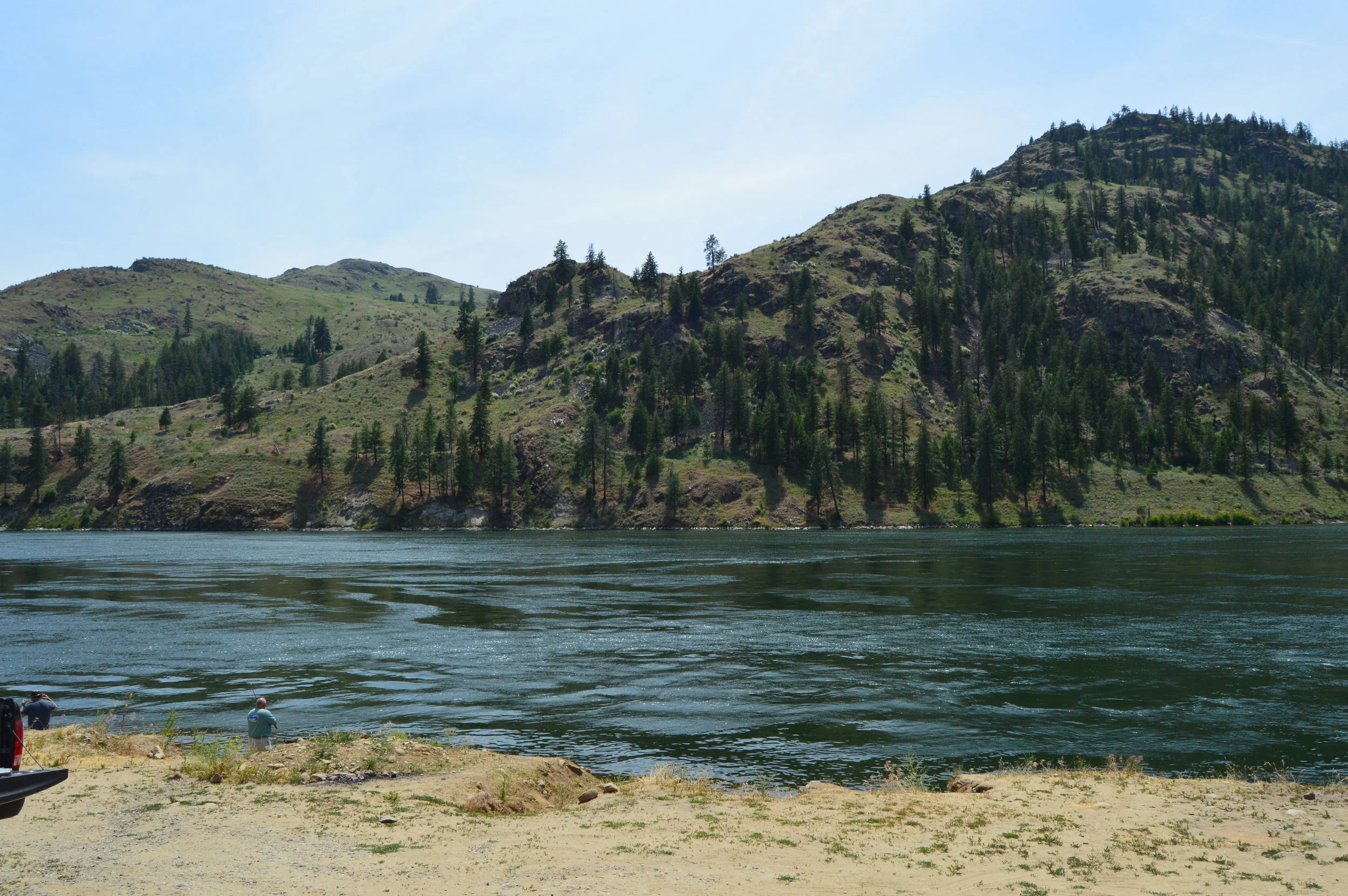
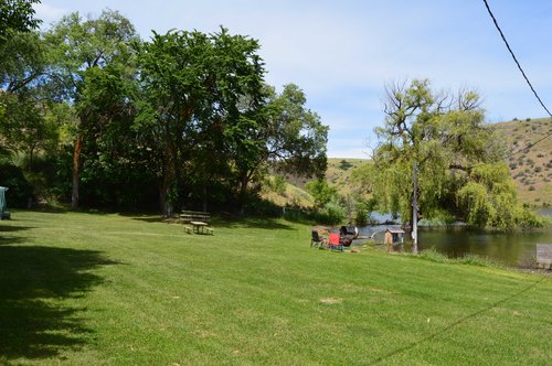
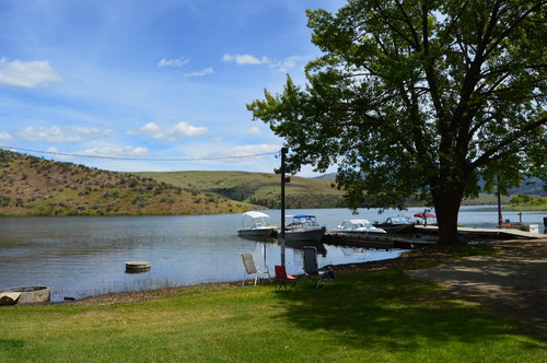
People are beginning to discover the natural beauty and bountiful lakes that are located within the Colville Reservation. Whether you are a camper, hiker, fisher or biker, there is something for everyone looking for that escape from city life. With miles of sandy beach and hidden gems isolated from the general population, the Colville Indian Reservation helps rest and relax your body, spirit and mind. There is something special about being away from the stresses of every day life that rejuvenates a person. While vacationing on the Colville Indian Reservation, you’ll relearn words and phrases such as fun, exciting, beautiful, breathe-taking, peaceful and “it don’t get any better than this,” but you’ll forget stress, timelines, brown nosing and traffic. It is the perfect getaway that helps you balance yourself with nature and the surrounding environment.
The Colville Indian Reservation is all about the beauty undeveloped landscaping offers. Many of the attractions are for naturalists, either people who enjoy the beauty of non-industrialized areas or the plant life and wildlife involved with it. So whether you simply want to escape to a comfort zone, view plentiful plant and wildlife or create your own fishing tales, the Colville Indian Reservation is right for you.
Barnaby Creek / Barnaby Island Barnaby Creek is located about 500 feet off the Kettle Falls road, approximately 15 miles north of Inchelium. During the fishing season, many people enjoy catching fish and exploring Barnaby Island. The island sits about half of a mile off the shoreline and is provides an exceptional view. Privacy is abundant and many people enjoy the quiet solitude this island offers.
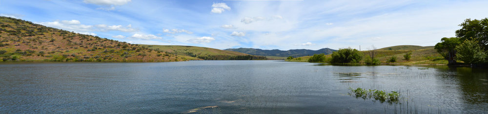
Big Goose Lake & Little Goose Lake Big Goose Lake and Little Goose Lake are located to the south of Omak Lake, on the Omak Lake road. Big Goose Lake is approximately two miles long. Its marshy wetlands lined with cattails and swamp grass makes it an ideal camouflaged habitat for waterfowl. The water is filled with lily pads providing bass with an excellent habitat.
Coyote Creek Coyote Creek is located in the western part of the Reservation and is approximately 10 miles from Nespelem, Washington, off All-American Highway 155. Coyote Creek campground is positioned with access from 155 and from the Coyote Creek / Kartar Road. The site provides a quiet picnic setting with restroom facilities to all travelers moving through the Reservation. This site is approximately 10-12 acres in size and is particularly appealing due to its remoteness and physical features including tall pine, mountain grass and ferns.
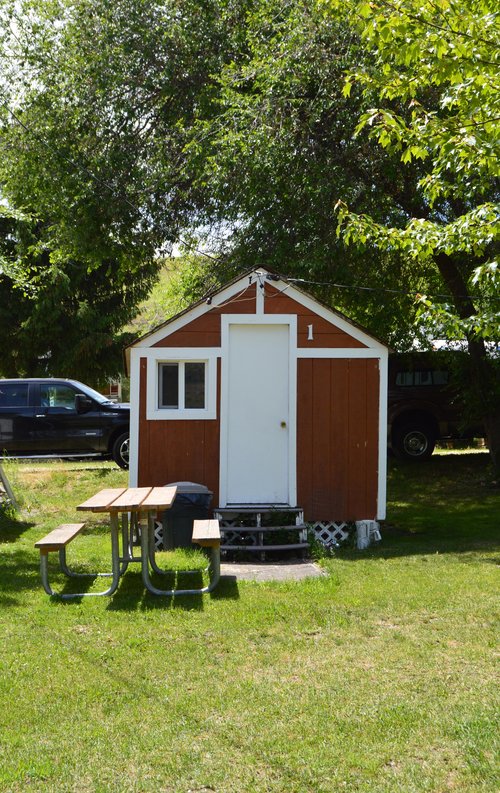
Keller Park Keller Park is located two miles south of Keller, Washington, adjacent to Highway 21. The park is located along the San Poil River and the mouth of the Columbia River. It encompasses four acres with picnic tables, barbecue pits, boating / swimming docks, restrooms and camping facilities. It is a great stop for those coming from, or heading to the Canadian border.
Omak Lake/Mission End The Mission End is located five miles south of All-American Highway 155 on the Paschal Sherman Indian School road approximately nine miles southeast of Omak, Washington. This site is equipped with a boating / swimming dock. Omak Lake is twelve miles long with sandy beaches located on the southwest, northwest and northeast shores. The boating dock is located at the northeast shore. The lake is stocked with various game fish and is open to the general public on a permit basis.
Omak Lake/Nicholson Beach Nicholson Beach is located on the west side of Omak Lake. Access to this area is by Kartar Valley road or Omak Lake road. The site is approximately 100 acres in size which includes a quarter mile of sandy beach used for swimming, boating, camping and fishing. The facilities include campsites and outhouses. The lake is restricted to day use only—no overnight camping is allowed.
Rocky Point Campgrounds Rocky Point Campgrounds are located 100 feet off the Bridge Creek road, along the northeastern shoreline of North Twin Lakes. Current facilities include outhouses, fire rings, garbage cans and a boating / swimming dock.
Roger's Bar Roger’s Bar is located off the Silver Creek road approximately 20 miles south of Inchelium along Lake Roosevelt. Local residents and boaters alike unwind at the secluded inlets and sandy beaches. Warm, sunny days make this spot a must for people seeking to enjoy a relaxing vacation, afternoon outing, or weekend camping trip. Present facilities include outhouses, picnic tables, fire rings and sandy beaches.
Rufus Woods Net Pens The Rufus Woods Net Pens are located approximately seven miles southwest of the Colville Indian Agency on the Columbia River road. This site is approximately four acres in size and currently has three developed campsites with one outhouse. This area is open year around and primarily used by fishermen seeking the Columbia River trophy trout.
Swawilla Basin The Swawilla Basin is located in the south central part of the Reservation, approximately five miles upstream from Grand Coulee Dam and 6 miles downstream from the San Poil Park. The site is approximately 10 acres in size with sandy beaches and private coves, a prime attraction for campers, boaters and fisherman.
Thirteen Mile Creek Campground Thirteen Mile Creek Campground lives up to its name, approximately thirteen miles from Republic off highway 21. It serves as the gateway into fourteen miles of backcountry trail riding. This campground includes a parking area, campground spurs, fire rings, restrooms, a loading ramp, four hitching rails, picnic tables and a watering hole for horses.
Twenty One Mile Creek Campground Twenty One Mile Creek campground sets off to the right of Highway 21, along the San Poil River. Nestled in tall pines, amidst a deep canyon, it is the perfect location for summer camp.
Wilmont Bay Wilmont Bay is located off the Silver Creek road nearly 24 miles south of Inchelium. Hidden amidst the tall pines, this inlet invites vacationers into an environment of quiet broken only by the beautiful crashing of a waterfall. Swim, picnic, and relax with amenities including picnic tables, outhouses, and garbage cans.
McGinnis Lake McGinnis Lake is a 115-acre lakes that offers brook and rainbow trout, along with large-mouth bass and crayfish. It has public access and requires a tribal fishing permit for non-tribal members. For more information about fishing McGinnis Lake check out the fishing report.
Non-Tribal Members Camping Sites
Rainbow Beach Resort Rainbow Beach Resort’s main purpose is to provide a vacation resort in a remote area. The resort is located a few miles west of Inchelium, Washington and offers a variety of activities on and around the beautiful 1,721 acre Twin Lakes area. A wide variety of birds and wildlife are abundant around the lake. North twin offers one of the few loon nesting areas in Washington state. Other activities include water skiing, swimming, biking & hiking. Rainbow Beach provides cabins, RV spaces and boat rentals. The cabins range from non-modern to grand and deluxe models. During the winter months, the lake is known for its ice-fishing. You can catch rainbow trout, eastern brook and large-mouth bass. Link
Lake Rufus Woods - Net Pens | Open Year Round
Buffalo Lake | Public Access Campgrounds | Open April 1 through second Sunday in November
North Twin Lakes | Rocky Point | Open April 1 through second Sunday in November
Lake Roosevelt | Rogers Bar Campgrounds, AA Camp (Bissel flats), Wilmont Creek Campgrounds, Barnaby Creek Campgrounds | Open April 1 through second Sunday in November
San Poil | Keller Park, Bear Creek Campground, 21 Mile Campground, 13 Mile Creek Campground | Open April 1 through second Sunday in November
Omak Lake | Mission End campground open April 1 through second Sunday in November
Bridge Creek Campground | Open April 1 through second Sunday in November
Highway 155 | Coyote Creek Campground - Upper Level | Open April 1 through second Sunday in November
Boating and Water Use Regulations; Non-Member ORV Use Regulations; and Non-Member Camping Regulations, Seasons and Area PDF
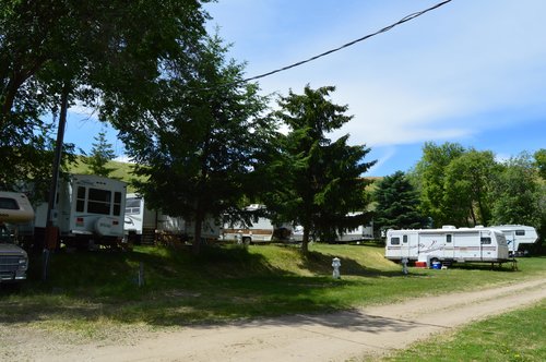
+ Reynold's Resort
Reynold's Resort is located on Buffalo Lake approximately 5 miles South of Nespelem, WA.
- RV Sites, Rustic Cabins, Tent Camping, Boat Launch, Fishing Permits, Boat Rentals, Swim Dock.
- Resort (509) 633-1092 or Colville Tribes and Recreation Office at (509) 634-3145 Email: mike.hall@colvilletribes.com
Reynold's Resort Fees: Reservations required for RV, Cabin and Tent Camping with a $25 non-refundable deposit. PDF
RV Camping: $40 per day (full hookup to water, sewer, electricity) $250 per month (full time) or $200 per month (come and go).
Dry Camping: $35 per day (no water or electricity)
Cabins (no water):
- Cabin 1-2: $25
- Cabin 3-4: $30
Tent Camping:
- Camping Fees: $35 day
Boat Launch: $10; Annual is $80, valid one year from date of purchase.
Boat Rentals: $20 per day without motors
Boat with motor (provide own fuel): $40 per day
+ Lake Roosevelt National Recreation Area
Lake Roosevelt | Rogers Bar Campgrounds, AA Camp (Bissel flats), Wilmont Creek Campgrounds, Barnaby Creek Campgrounds | Open from June - October PDF
+ Geographic Area
The Colville Indian Reservation is the homeland of estimated 7692 residents in north central Washington. Covering 1.4 million acres or almost 2,100 square miles, the diverse landscape of the area provides numerous opportunities for socioeconomic development. Lakes and streams offer outdoors-recreational pursuits for both the visitors and the residents of the Reservation. The Tribe intends to preserve the land and traditions of the Indian People. At the same time, self-sufficiency and sovereignty will be advocated as the Tribe utilizes the many resources available to improve the Reservation.
The Colville Indian Reservation is located in the north central section of Washington State. It is bounded on the east and south by the Columbia River, on the west by the Okanogan River and on the north by the line between Township 34 & 35 north of the Willamette base line. The elevation of the reservation lands generally increase from south to north and from west to east. Elevations range from 790 feet at the mouth of the Okanogan River to 6,774 feet at the summit of Moses Mountain. Average elevation is above 3,000 feet.
Current land use on the Reservation includes residential areas, irrigated and dry lands farming, livestock range areas, commercial forests, recreational areas, and mining areas. The major land use categories are summarized as follows:
Residential 1,195 acres 0.1%
Agriculture 82,066 acres 5.8%
Open Rangeland 287,825 acres 20.7%
Forested Rangeland 135,105 acres 9.7%
Forest 878,402 acres 63.1%
Surface Water 7,672 acres 0.5%
Total 1,392,265 acres 100.0%
Reflecting the Tribes abundant resources, which represents the bulk of Tribal revenues, the Forest-type category of land classification total almost two-thirds of the Reservation land area. Open Rangeland and Forested Rangeland account for almost one-third of Reservation lands with Residential, Agricultural, and Surface Water comprising the remainder. The diverse types of land may serve to broaden the Tribes economic base by offering economic development alternatives for the Reservation.